The Hikes We Like: 10 Epic Treks to Tackle This Summer
With the Rocky Mountains in our frontyard, and the Purcell Mountains in our backyard, we’ve got no shortage of epic hikes to meander through during the warmer months. From family-friendly and close-to-town options, to more challenging and further-away objectives, a day spent hiking here is a day well-spent. Stay tuned for 10 of the most iconic close-to-Kimberley trails to tackle this summer and beyond.
Rocky Mountains
- Tanglefoot Lake. Sparkling water and picturesque views of Mount Fisher make Tanglefoot Lake one of the most beloved South Rockies hikes in the area. Enjoy a meandering wander through the wildflower-dotted Mause Creek Tarns before climbing the well-worn trail to the shores of the deep and clear subalpine lake. Explore further with an additional 2.4km and 314m up to Windy Pass, or embark on an epic traverse by completing the long day-loop along the Five Passes trail
Distance: 4.3km from Mause Creek Trailhead to Tanglefoot Lake
Elevation gain: 535m
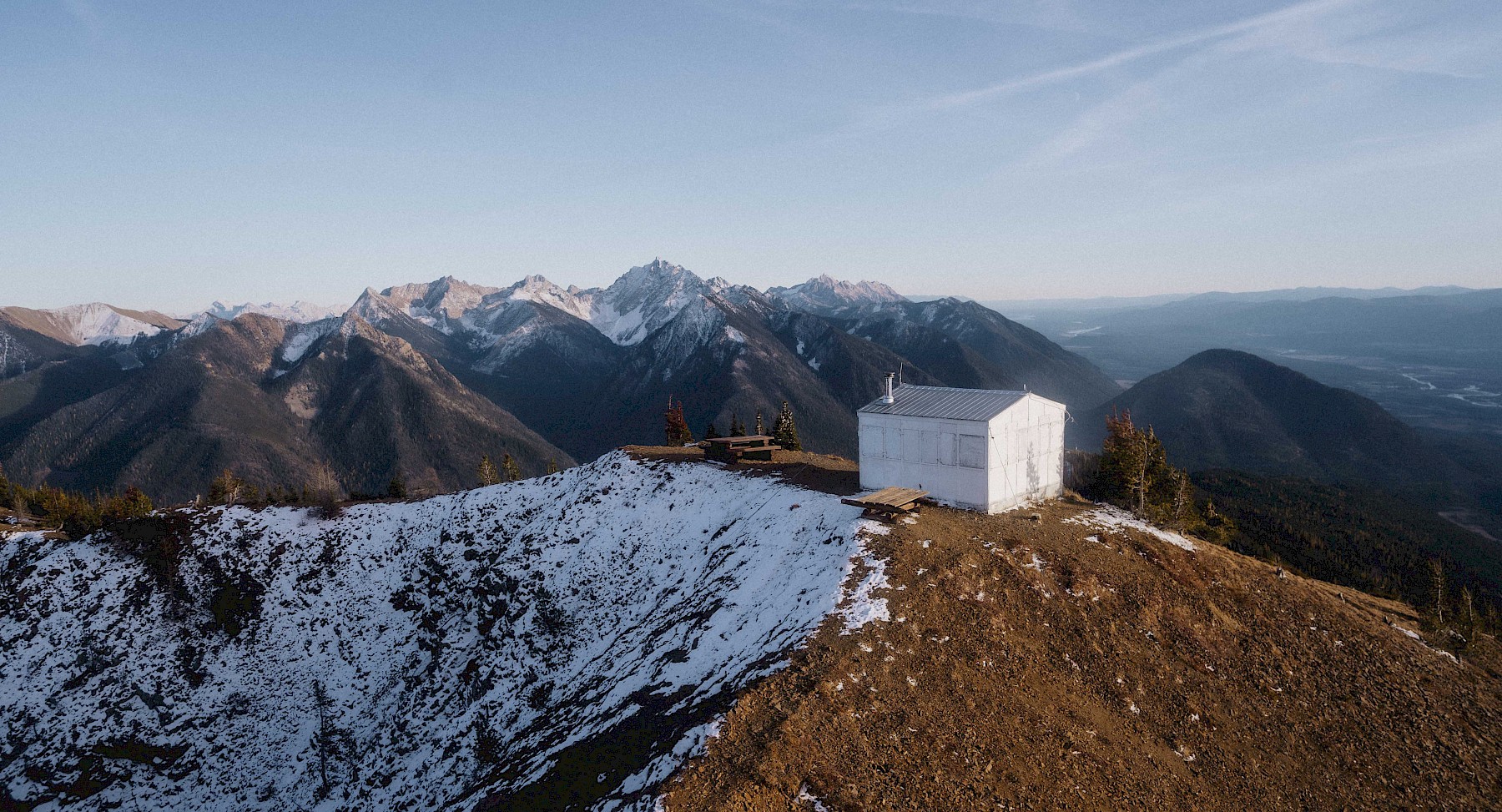
- Lakit Lookout. The relatively short distance and panoramic views of the Kootenay River Valley and the Rocky Mountain Trench make Lakit Lookout one of our favourite family-friendly alpine hikes. Following a long drive up a steep and narrow road, you’ll reach the trailhead and begin your switch-back ascent to an old firewatch tower that was in use until 1967. Further exploration can be enjoyed with a 2km ridgewalk to the summit of Lakit Mountain
Distance: 2.3km from Lakit Lookout Trailhead
Elevation gain: 480m
- Bear Lake. Enjoy this short and steep hike to the clear, cold Bear Lake. Dotted with grassy meadows and blooming subalpine flowers, Bear Lake makes for the perfect outing for beginner hikers or backpackers. Continue your adventure by climbing an additional 213m up to the pass between Bear Lake and Rualt Lake. This well-defined trail winds up to a stunning ridgeline, with views of Mount Rualt, Empire State Peak, and the beloved Summer Lake in the distance
Distance: 2.5km from Bear Lake Trailhead
Elevation gain: 300m to the lake
- Top of the World Provincial Park. Top of the World Provincial Park is a remote wilderness park that offers many different options for camping and hiking. Most travelers begin with the 6.2km hike into the popular and family-friendly Fish Lake. Here, you’ll find 16 tenting sites, pit toilets, and even a first-come, first-served cabin to enjoy. From Fish Lake, avid adventurers can set their sights on some bigger objectives, such as Sparkle Lake (an additional 2.8km and 350m gain from Fish Lake), Wild Horse Ridge (an additional 3.2km and 640m gain from Fish Lake), or even the domineering Mount Morro, which soars to a height of 2912m, and is a lofty multi-day objective for seasoned outdoors-people
Distance: 6.2km to Fish Lake from Top of the World Provincial Park Trailhead
Elevation gain: 213m to Fish Lake
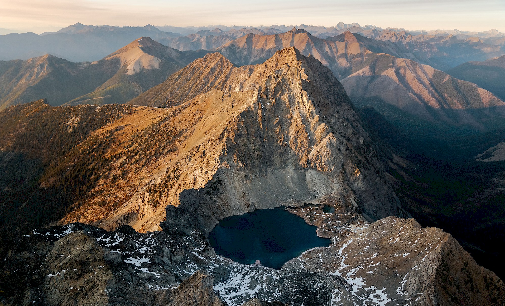
- Mount Fisher/Fisher Peak. As iconic as they come, Mount Fisher is one of the most dominating peaks in the Southern Rockies. Though a well-travelled, popular route, Fisher Peak does come with its challenges: expect a strenuous journey with a minimal amount of route-finding and some loose scree to navigate in the upper cirque. Consider leaving your furry friends at home for this one, as some light scrambling is also required near the summit. At the top, enjoy sprawling views of the Rocky Mountain trench, and the blue depths of Nicol Lake below
Distance: 4.5km from Mount Fisher Trailhead
Elevation gain: 1340m
Purcell Mountains
- Mount Evans. The Evans Basin and Mount Evans Summit hike is a rewarding jaunt in the Purcell Mountains behind St. Mary Lake. Meander along switchbacks to reach Evans Basin, then continue past the cabin ruins and mine tailings to find a faint trail leading steeply up a forested slope. The trail to the ridgeline can be indistinct, and the route to the Mount Evans Summit does require some scrambling. Those who choose to not complete the final, exposed push to the summit will still be rewarded with panoramic views of the Purcells from high above on Evans Ridge. We hear this area is extra stunning during the autumn when the larch trees are in their golden glory
Distance: 5.4km from Mount Evans Trailhead
Elevation gain: 524m to cabin ruins, another 869m to Evans Ridge and Mount Evans
- Pyramid Creek. Deep in the Purcell Mountains behind Kimberley, you’ll find this strenuous loop hike featuring talus slopes and rugged alpine views. Prepare for a long and steep journey through cedar forests before taking in the views from atop Pyramid Pass. Keep your eyes peeled for curious mountain goats on the surrounding mountaintops, and be on the lookout for the faint trail markers that help guide your way back to the trailhead
Distance: 13.5km loop from Pyramid Creek Trailhead
Elevation gain: 1370m
- Hourglass Lake. The perfect outing on a hot, summer day, the hike into Hourglass Lake offers adventurers a nice respite from the heat, with forested trails on the ascent, and cool, shimmering waters to plunge into once at the lake. After arriving at the lower lake, explore further past the narrows to the west end of the lake, then climb up another 335m on a steep, talus rock slope to reach the scenic Upper Hourglass Lake. Once you reach the top of the slope, take in the peaceful shoreline of Upper Hourglass Lake, and be sure to look back at the direction from which you came to discover why Hourglass Lake is so appropriately named
Distance: 3.2km to Hourglass Lake Narrows
Elevation gain: 300m to the Narrows
- Dewar Creek Hot Springs. Located in the Purcell Wilderness Conservancy, the Dewar Creek Hot Springs are as out-there and off-the-beaten-path as it gets. Enjoy a lovingly constructed hot springs pool with temperature-controlled taps, isolated surroundings, and the chance to glimpse wildlife in their natural habitat here (hint: this is Grizzly country, folks. Bring bear spray with you, and always visit with a group). In order to reach these springs, you should be in good physical health and able to easily make a 20km round-trip on foot. Camping here is on a first-come, first-served basis, and is available on established tent pads only
Distance: 11km
Elevation gain: 225m
- Mary Ann Falls. This out-and-back trail is perfect for adventurous travellers looking to add some elevation into their waterfall explorations. Short but steep, the efforts of the hike are rewarded in full once arriving at the lookout, or when splashing in the runoff below. Bring your binoculars for bird-watching along the way, and don’t forget to pack a picnic lunch to eat while soaking up the views of St. Mary Lake far below. Please note: the Mary Anne Falls trail resides on private land, and is accessible upon agreement with the landowner. Please practice Leave No Trace principles while here to ensure that future visitors and locals can continue to enjoy this beautiful spot
Distance: 2.3km from Mary Ann Falls Trailhead
Elevation gain: 385m
Bonus: Our In-Town Trail Networks
Around here, you don’t have to wander far to find a good time. Stick within town limits and hit the trails right from your front door. There are over 100km of established trails to enjoy here, with the Kimberley Nature Park alone spanning over 800 hectares of variable terrain and stunning viewpoints. Our in-town trail networks include: the Kimberley Nature Park, the Lois Creek Trails, the Kimberley Nordic Centre, and the Horse Barn Valley Interpretive Forest. Some of our favourite summits in town include Myrtle Mountain, Musser’s Plateau, and the beloved T-bar Climb.
Tips & Considerations
All good wilderness adventures start with a little forethought. Take time to plan your route, pack your essential forget-me-nots, and gear up appropriately for your great hike ahead.
- Stop by the Visitor Centre for route advice and additional planning tools
- Study trail descriptions and maps before setting out
- Familiarize yourself with driving directions, and be aware that many of our hikes require high-clearance, 4x4 vehicles to access
- Pack adequate food, water and clothing
- Bring along a stocked First Aid Kit and an emergency repair kit
- Be aware of wildfire risk and fire bans, and always avoid making fires in alpine areas
- Carry bear spray, know how to use it, and be aware of local wildlife
- As cell phone reception is unreliable in our further out trails, bring along a satellite communication device in case of emergencies
- Kimberley Search and Rescue (SAR) is our local non-profit volunteer group, trained to locate and rescue lost or injured persons. Call 911 to reach the Kimberley SAR team
- Stay on established trails to avoid disturbing plants and wildlife
- Respect road and trail closures
- Leave no trace: pack out all garbage and food waste
- Have fun out there!