
Kimberley Trails: Exploring within City Limits
Around here, you don’t have to wander far to find a good time. Stick within town limits and hit the trails right from your front door, with easy access to paved paths, ski runs, and plenty of down-and-dirty single and double-track trails. No matter which season you visit in, or which activity you choose, we’ve got you covered with more in-town options than can possibly fit into most itineraries. Good news: return visits are strongly encouraged here.
Explore the Kimberley Nature Park
Located entirely within Kimberley’s community boundaries, our 800-hectare Nature Park is twice the size of Vancouver’s Stanley Park and boasts the title of the largest municipal park in British Columbia. Enjoy 50 km of established trails by foot, mountain bike, snowshoe or cross-country skis. Popular walking trails include Sunflower Hill and Myrtle Mountain, while mountain bikers find fun on Trickle Down and Resident’s Choice. And with over 600 meters of elevation change at the foothills of the Purcell Mountains, our Park’s diversity is remarkable. Animals you may spot along the way include Canada’s only native boa constrictor, moose, deer, and the western painted turtle. Additionally, our Nature Park is the perfect place for larch-viewing come fall, or for a walk amongst the wildflowers in the spring.
DIRECTIONS: From our downtown Platzl, the closest Kimberley Nature Park trailhead is a mere 10-minute walk away. Head south along Wallinger Avenue and take a right at Stoke Market onto Swan Ave. At the far end of Swan Ave., you’ll find a main Nature Park Trailhead, as well as ample parking spaces and a map kiosk. Additional trailheads can be found near the Kimberley Riverside Campground and the Kimberley Alpine Resort.
Trek through the Horse Barn Valley Interpretive Forest
The Horse Barn Valley Interpretive Forest is adjacent to the Kimberley Nature Park and consists of about 9km of established double-track and singletrack trail options. This 200-hectare parcel of land contains an old-growth cedar forest, Dipper Lake, the Halfway Cabin, and a number of well-maintained trails that can be enjoyed all throughout the year. It is a popular destination for hikers and mountain bikers and transforms in the winter with groomed, fat biking tracks and options for snowy jaunts by snowshoe. Popular hiking and biking trails here include Tora Bora, Mr. Toad, and Thunder Turkey.
Fun Fact: The Halfway Cabin was built from 1934-1935 by a handful of Kimberley residents as a ski shelter between the original Myrtle Mountain ski hill and the Matthew Creek access road. The original structure was built with hand-hewn logs and a cedar shake roof. A major restoration of the original structure took place in 1994, and the cabin continues to be used today as a resting place and warm-up spot during long outings in the Horse Barn Valley.
DIRECTIONS: Locate the Horse Barn Valley Interpretive Forest by hiking or biking east through the Kimberley Nature Park, or by driving to the Horse Barn Valley Trailhead via the Matthew Creek Forest Service Road (FSR). Note: this is an unpaved backroad with a few bumps along the way. High-clearance vehicles are recommended.
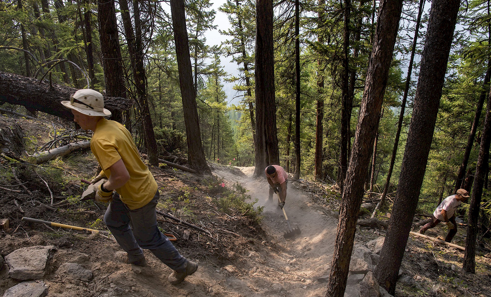
Shoutout to our Trail Builders
The non-profit Kimberley Nature Park Society (KNPS) stewards and promotes the Kimberley Nature Park and the Horse Barn Valley Interpretive Centre. The KNPS maintains the information kiosks and signage, and produces a detailed topographical guide of the park. A PDF of the map can be viewed online, purchased at the Kimberley Visitor Centre, or viewed at any of the kiosks throughout the park. Support ongoing efforts of the KNPS by donating here.
Glide through the Kimberley Nordic Club
The Kimberley Nordic Club is a not-for-profit organization whose goal is to foster Nordic skiing as an affordable and lifelong winter activity. Recreational cross-country skiing has a rich 50-year history here, with the early miners using the base of North Star Mountain for rudimentary ski routes. The Nordic Club has since transformed into a first-class facility for serious athletes and casual enthusiasts alike.
Winter Use
The trails consist of a variety of groomed double-track and single-track that are great for both classic and skate skiing. These routes offer varying degrees of difficulty and length, and are exclusively reserved for cross-country skiing during the winter months. The facility includes a 1,200 sq foot lodge, with washrooms and a racers’ warming/waxing hut. There are 30km of groomed double-track trails to enjoy, a 3.3km lit loop for night skiing, a 1km spiny loop, 5km of single-track trails, and Paralympic-friendly zones.
Note: A nominal fee is required for winter use; ski rentals are available on-site; and furry friends are only allowed to join in on the adventure during the non-winter months.
Summer Use
In the summer, the Nordic Club trail network transforms into a multi-use mecca for single-track and double-track seekers. These trails are free for public use outside of winter operations, and showcase some local favourite bike rides like Magic Line, Uppercut, and Sidecut. Enjoy these trails on foot or by bike, or bring along the e-bike for a little assist on some of the Nordic Club’s bigger inclines. While adaptive riders can find fun along the double-track trails, conventional wheelchairs and strollers are not well-suited for the woodchip and unsurfaced trails.
Additional trail and route information is available online or at the trailhead near the Nordic Club parking area.
DIRECTIONS: Those staying near the Kimberley Alpine Resort can easily access the Nordic Club via a short walk, bike, or ski. From the Platzl, head 4km up Gerry Sorensen Way until the road becomes North Star Drive. Find the Nordic Club parking area at the end of North Star Drive.
Carve down the Kimberley Alpine Resort
The Kimberley Alpine Resort is known for its consistent snowfall, short lift lines, and an abundance of sunny days year-round. In the wintertime, skiers and riders of all abilities can find fun on the 80 trails spread across 1,800 acres of terrain. The Mountain can also be enjoyed by a ski-tour along the designated up-track route, or with guided snowshoe tours to the top.
In the summertime, the Mountain becomes a popular hiking and biking destination with both locals and visitors. Try your hand at the Ski Hill Climb to enjoy Rocky Mountain views and a bird’s eye perspective of Kimberley. Then, cruise back down the way you came, or enjoy the scenic way down with a trip through Musser's Plateau and Moe's Canyon. Looking for more? Our 20km Round the Mountain loop begins at the Kimberley Alpine Resort, and circumvents North Star Mountain on an epic journey through rock slides and cruisy single-track.
DIRECTIONS: From the Platzl, head 3km up Gerry Sorensen to the base of the Mountain. Parking for the Up-Track, the Ski Hill Climb and the Round the Mountain trail can be found 1km further up Gerry Sorensen, near the Kimberley Nordic Club.
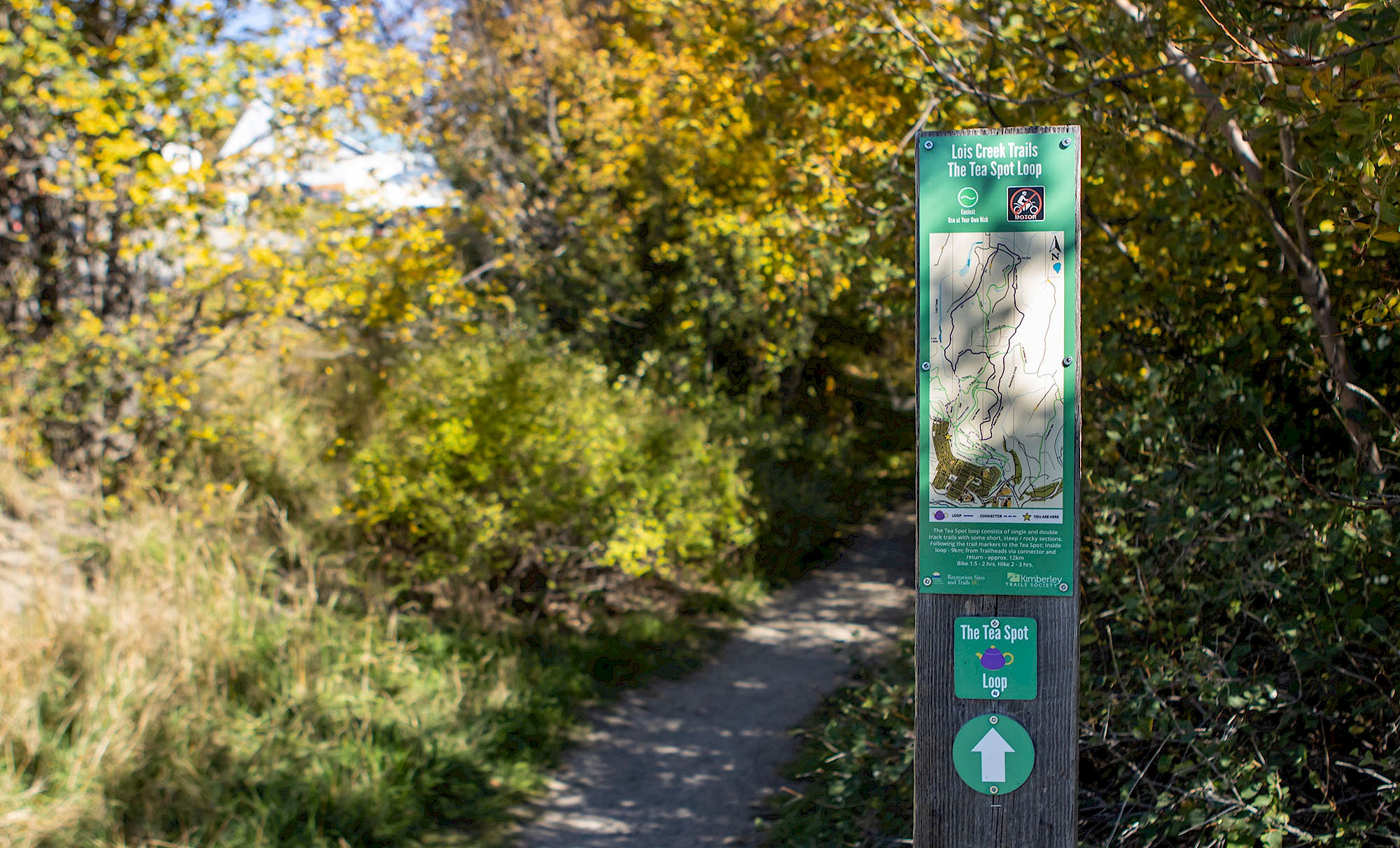
Cruise the Lois Creek Trails
The Lois Creek network is suitable for beginner to intermediate explorers and features double-track and single-track trails that weave through mature forests and alongside Lois Creek. Not only are the trails popular for biking and hiking in the summer and fall, they are also a local favourite for cross-country skiing and snowshoeing in the winter. We suggest checking out the 10 km Tea Spot loop all throughout the year for a viewing of the beautiful Canadian Rockies. Bonus: we hear the larches really come alive in this area during the fall.
DIRECTIONS: From the Platzl, find the nearest Lois Creek Trailhead by cruising along Wallinger Avenue towards Centennial Hall. Look left to find the trailhead where Wallinger Ave. and Waldie Rd. meet. Ample free parking is available at Centennial Hall.
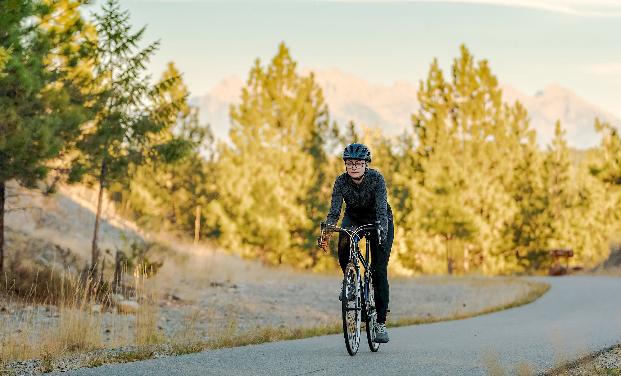
Coast along the North Star Rails to Trails
Converted from a stretch of the Canadian Pacific Railway, the North Star Rails to Trails is a “trail of two cities” linking Kimberley to nearby Cranbrook. This 26 km paved path is part of the Trans Canada Trail and is suitable for users of all ages and skill levels. Enjoy a cruisy ride to Cranbrook, before hitching a lift back to Kimberley along the Kimberley-Cranbrook commuter bus, or enjoy the 52 km round-trip while soaking in expansive views of the Canadian Rockies and the St. Mary River. The trail has 3 public washrooms located throughout, as well as repair stations at either end of the trail. The Rails to Trails is suitable for road bikes, e-bikes, and any kind of non-motorized stroller, roller, or strider around. It is also well-suited for wheelchair users or adaptive riders.
Heads up: the route heading towards Cranbrook is a bit more cruisy and “downhill” than the bike back towards Kimberley is. While the trail stays below a 3% grade throughout, be sure to save some energy and water for the moderately hillier return home.
DIRECTIONS: From the Platzl, the closest trailhead is a cruisy 4-minute bike ride away. Head down Rotary Drive and find the trailhead directly across from Rotary Park and the Kimberley Civic Centre.
Practice in the Park
Looking to work on your skills before hitting the trails? The Kimberley Skate Park & Mountain Bike Skills Park is open for skateboarding, BMXing and mountain biking. The outdoor park showcases a wide variety of ramps, verts, bowls, and rails for use, and has suitable features for pros or beginners alike. The park is located at the corner of Marsden and Rotary Drive, and is accessible via a short bike or skate from the Platzl, or down the first stretch of the Rails to Trails.
Rent your Gear
No gear? No problem. Come as you are, and leave the rest up to us. Whether you’re hitting the trails in winter or in summer, our local providers can set you up for success with gear of choice and insider tips on what not to miss.
- Black Dog Cycle & Ski offers fat bike, mountain bike, e-bike, and ski rentals
- Kimberley Alpine Resort offers fat bike, ski, snowboard, snowshoe, skate rental, plus other associated winter gear like helmets and poles
- Bootleg Bike Co. offers fat bike and mountain bike rentals
- Kimberley Nordic Club offers skate and classic cross-country ski rentals
- Kimberley Riverside Campground offers mountain bike rentals
Final Tips
While our in-town options are enough to keep any adventure-seeker busy during a stay here, we’ve got some great further-out trails for those looking to get higher in the mountains, far out on our roads, or a little more advanced in their downhill rides. Remember that all the best outings here start with a quick visit to the Kimberley Visitor Centre for maps and route-planning suggestions, and end with a little cheer at one of our local drinkeries or eateries. Plus, while fun-finding is always a top priority here, be sure to familiarize yourself with our trail etiquette and safety suggestions, and come prepared with plenty of gear and wildlife awareness. Most importantly, remember to bring along a healthy dose of fun and excitement, and give yourself a little extra time to take in our beautiful surroundings. We can’t wait for you to experience the trails here, and know you’ll love them just as much as we do.
We would like to acknowledge that Kimberley (k̓ukamaʔnam) and our surrounding trail networks are located on the unceded traditional territory of the Ktunaxa (?amak?is) Nation.