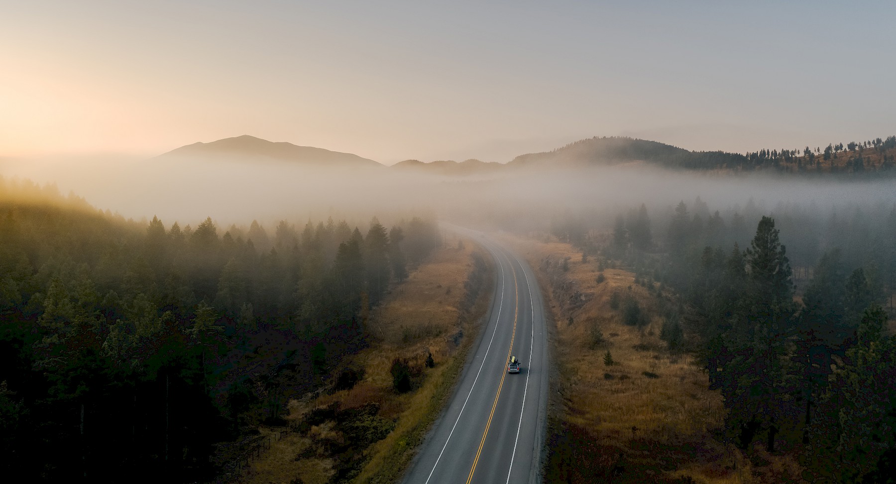
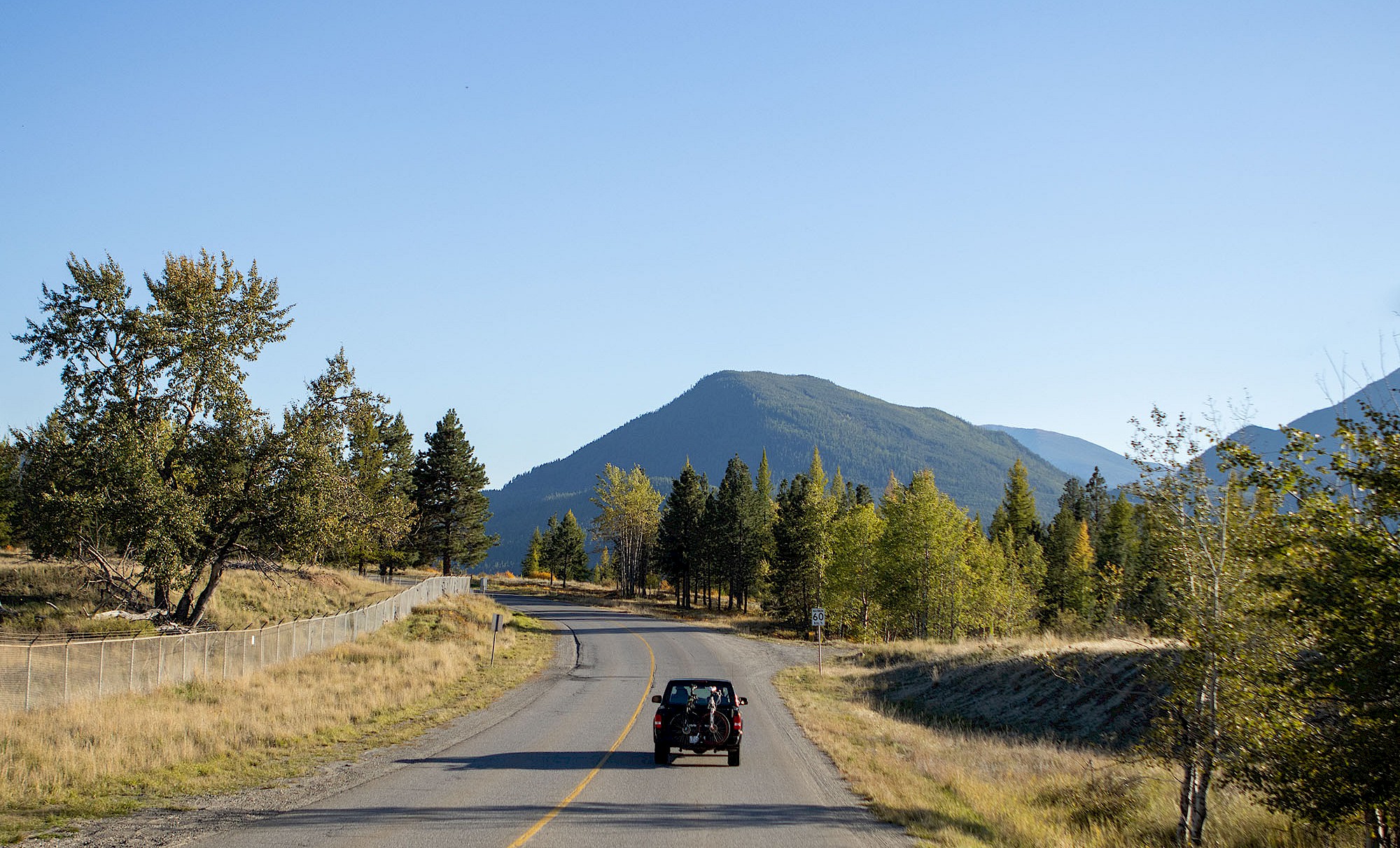
Hit the Road: Scenic Sunday Drives in a Good Place To Be
Here’s the thing: while we’re big proponents of getting out into our surrounding nature, we also believe that exploring need not be limited to on-foot or by-bike adventures. There’s plenty of dramatic mountain views, crisp lakes, seasonal foliage, and varied wildlife to see while winding down scenic roads with your favourite people in tow. Whether you’re a passenger princess taking it all in, or at the helm with the wind blowing through your hair, a scenic Sunday drive is a great addition to any stay here.
In Town
- Route 1: Jim Oglive Way to Marysville
Named after long-time former mayor, Jim Oglive, this roadway offers a birds-eye view of Kimberley’s Marysville neighbourhood, and peaceful vantage points of the rolling hills and distant mountain ranges that surround our community. We love this drive during golden hour, and always appreciate a quick pit-stop mid-way to admire the mountain views
Driving Directions: From Kimberley’s Visitor Centre, head to the traffic lights and make a right → take your next left onto Mark Street and continue onto Rotary Drive until you reach Jim Oglive Way → continue straight along Jim Oglive Way until the road intersects with Kimberley Highway/BC-95A
- Route 2: Gerry Sorenson to the Kimberley Alpine Resort
The road that leads to the Kimberley Alpine Resort is steep, twisting, and full of surprising vantage points along the way. Avid hikers or bikers can enjoy this route by taking the paved Peak-to-Platzl path from Kimberley’s downtown core, but trust us when we say that the drive is just as nice. Whether you take in a winter sunset at the top, or cruise this route during the fall when the surrounding hillsides are exploding with golden larch trees, there’s sure to be plenty of Rocky Mountain views to enjoy along the way
Driving Directions: From Kimberley’s Visitor Centre, exit onto Kimberley Avenue before taking a left onto Spokane Street → continue straight onto Gerry Sorenson Way for 2km → turn right onto North Star Boulevard to reach the base of the Kimberley Alpine Resort, or → continue 1km further up Gerry Sorenson and → take a slight left onto North Star Drive to reach the Kimberley Nordic Club a little higher up
What’s in a name? Named after local skiing ace, Gerry Sorenson Way pays homage to the World Champion downhill skier and olympian, Gerry Sorenson, who grew up and learned how to ski here
Purcell Mountains
- Route 1: St. Mary Lake Road to St. Mary Lake Regional Park
For a scenic drive that includes a pristine lake, riverside views, and plenty of Purcell Mountain scenery, head to St. Mary Lake Road and cruise your way to the St. Mary Lake Regional Park. Bring plenty of snacks and refreshments for the shoreline, and keep an eye on local bird species flitting around the water. The road to St. Mary Lake is a mix of asphalt and gravel, is well-maintained throughout the year, and is suitable for vehicles. Please use extra caution during the winter months, and be sure to switch over to your winter tires before heading out
Driving Directions: From Kimberley’s Visitor Centre, head to the traffic lights and turn right → continue for 6km then turn right onto St. Mary Lake Road → continue for 16km then turn left onto St. Mary River Road → turn right onto Lake Front Drive to arrive at St. Mary Lake Regional Park
- Route 2: Grey Creek Pass
The Grey Creek Pass is an unmaintained, gravel road that is generally snow-free and passable from July to October. High clearance, 4x4 vehicles are recommended for this route, as is an appropriate trip plan, as you will be outside of cell phone range for much of this journey. While winding through the Grey Creek Pass, expect to be treated with high vistas and thickly forested pathways on either side of the narrow road. Keep an eye out for passing wildlife, and bring along an appetite for adventure
Once you emerge on the other side, you’ll find yourself in the quaint community of Grey Creek along the shores of Kootenay Lake. Journey back through the Pass the way you came, or loop towards Highway 3 to make your way back to Kimberley
Driving Directions: From Kimberley’s Visitor Centre, head to the traffic lights and turn right → drive 6km and take a right hand turn onto St. Mary Lake Road → continue to follow St. Mary Lake Road past St. Mary Lake before making a left turn at the 38 km marker onto Redding Creek Road → Redding Creek Road will link up to the Grey Creek Pass, which you’ll then follow for 90km before arriving in Grey Creek
Rocky Mountains
- Route 1: Bull River FSR to Whiteswan FSR
For those looking to get lost in remote, backcountry wilderness, this route is for you! Enjoy peaceful gravel roads, thickly forested surroundings, and the chance to soak in plenty of mountain moments alongside stunning lakes and rushing rivers. Give yourself time to relax in the Lussier Hot Springs before finishing off the route, and don’t forget to bring along a good mapbook and trip plan for this adventurous off-road route. Please be aware that this road is not maintained during the winter months, is best suited for high-clearance, 4x4 vehicles, and is a full-day drive from Kimberley - please plan accordingly
Driving Directions: From Kimberley’s Visitor Centre, head to the traffic lights and turn right → follow Kimberley Highway/Wallinger Ave/BC-95A for 28 km before merging onto BC-3 East/BC-95 North → take the slight ramp with signs to Invermere/Radium Hot Springs → continue onto BC-93 North/BC-95 South for 8km → turn right onto Wardner-Fort Steele Road → follow to the Bull River Road in Wardner and turn onto the Bull River FSR → the unpaved road stretches for about 150km and takes at least 5 hours for the full passage, before emerging back on Highway 93/95
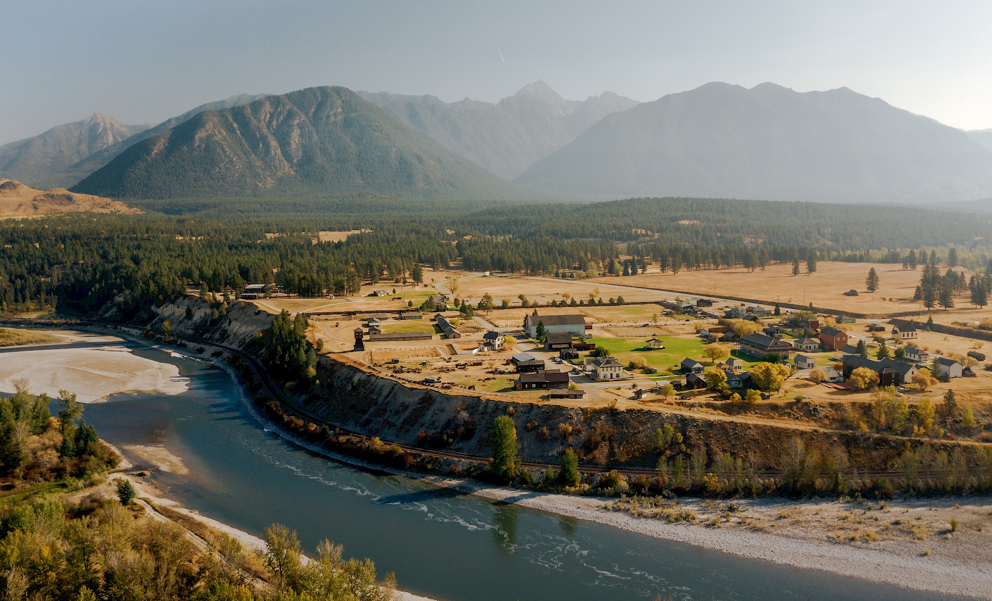
- Route 2: The Wardner-Fort Steele Road
The Wardner-Fort Steele Road is a scenic 35km drive along the banks of the Kootenay River, which connects Highway 93/95 at Fort Steele to the Crowsnest Highway at the Wardner Bridge. Highlights along this route include options to visit the Kootenay Trout Hatchery, views of flat ranchlands and sand cliffs along the road, and the chance to find a gold nugget or two in Wild Horse Creek that gurgles along the start of the drive
Driving Directions: From Kimberley’s Visitor Centre, head to the traffic lights and turn right→ follow Kimberley Highway/Wallinger Ave/BC-95A for 28 km before merging onto BC-3 East/BC-95 North → take the slight ramp with signs to Invermere/Radium Hot Springs → continue onto BC-93 North/BC-95 South for 8km → turn right onto Wardner-Fort Steele Road and follow for 35km
Like any good adventure on-foot, our further-out driving adventures deserve a little extra trip-planning and safety considerations. Be sure to download relevant maps and apps, and consider picking up a copy of the Kootenay Rockies BC Backroads Mapbook to take with you on your journey
Bonus
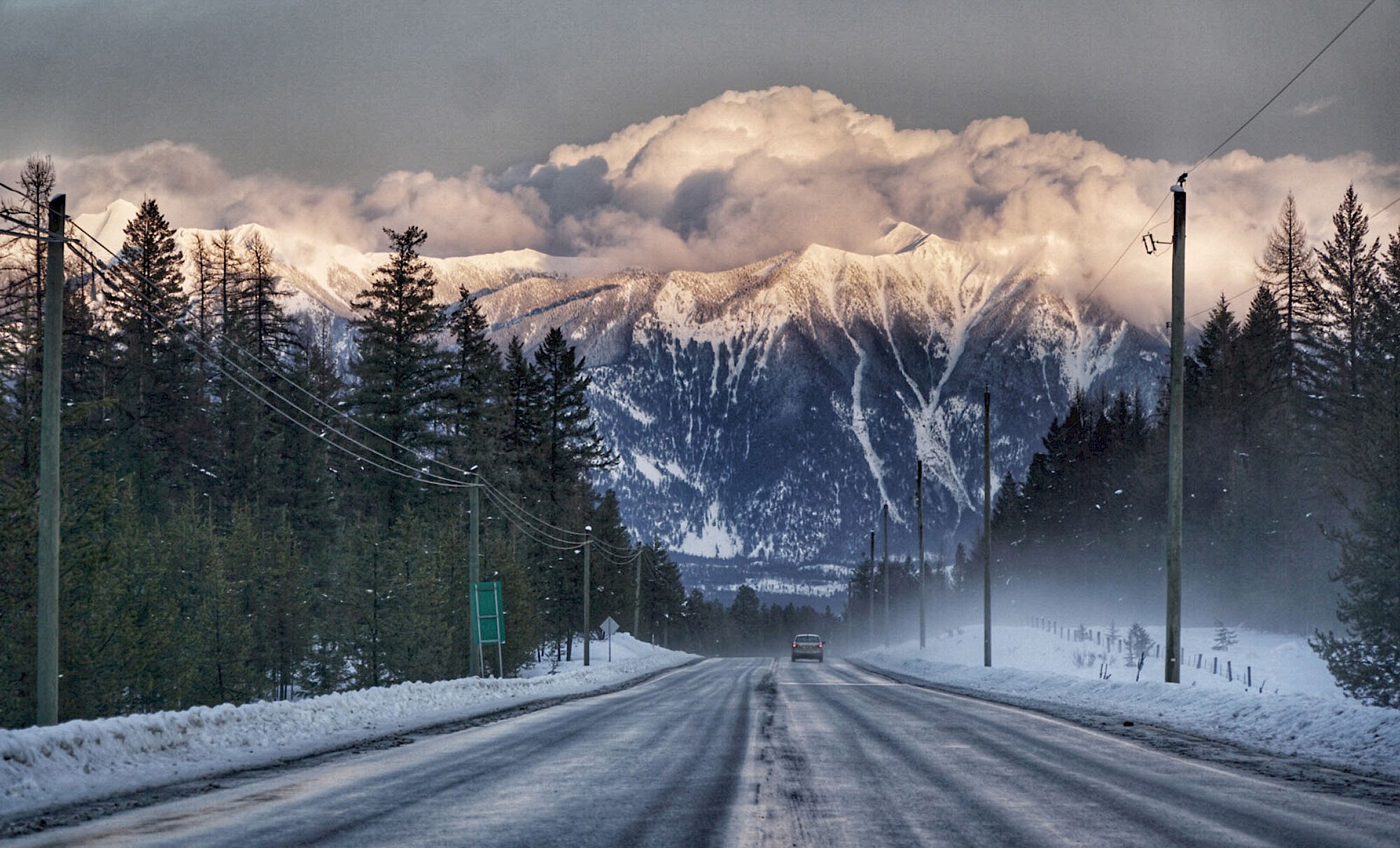
One of our favourite nearby drives is one that daily commuters know intimately. The drive between Kimberley and Cranbrook features epic Canadian Rocky scenery, bird’s eye views of the St. Mary River, and regular glimpses of the roaming herds of elk who winter in the fields next to Highway 95A. To make the most of this drive, head south towards Cranbrook at sunrise and take in the magical mountain views bathed in early light. Looking for more? Check out our curated itineraries to pair other great adventures alongside your chosen Sunday drive.